The mountains of Pakistan are essential components of the country’s natural, cultural, and economic landscapes, with contributions ranging from water supply and biodiversity to tourism and cultural heritage. Pakistan is home to several prominent mountain ranges, each with unique characteristics and significance. Western mountain ranges are one of the major mountain ranges in Pakistan. In this blog, we will explore the western mountain ranges of Pakistan.
Western Mountain Ranges Of Pakistan
The western mountain ranges of Pakistan are a series of mountain ranges that run along the western border of Pakistan. They are not as high as the northern mountains but still quite rugged and mountainous. The climate in the western mountain ranges is dry and arid, with little vegetation. The mountains are rich in minerals, including limestone, sandstone, and clay. The mountains are also home to a variety of wildlife, including snow leopards, ibex, and Marco Polo sheep.
The western mountain ranges of Pakistan are a popular destination for hiking, camping, and mountaineering. The mountains are also a popular destination for tourists, who come to see the stunning scenery and the variety of wildlife.
Sulaiman Range
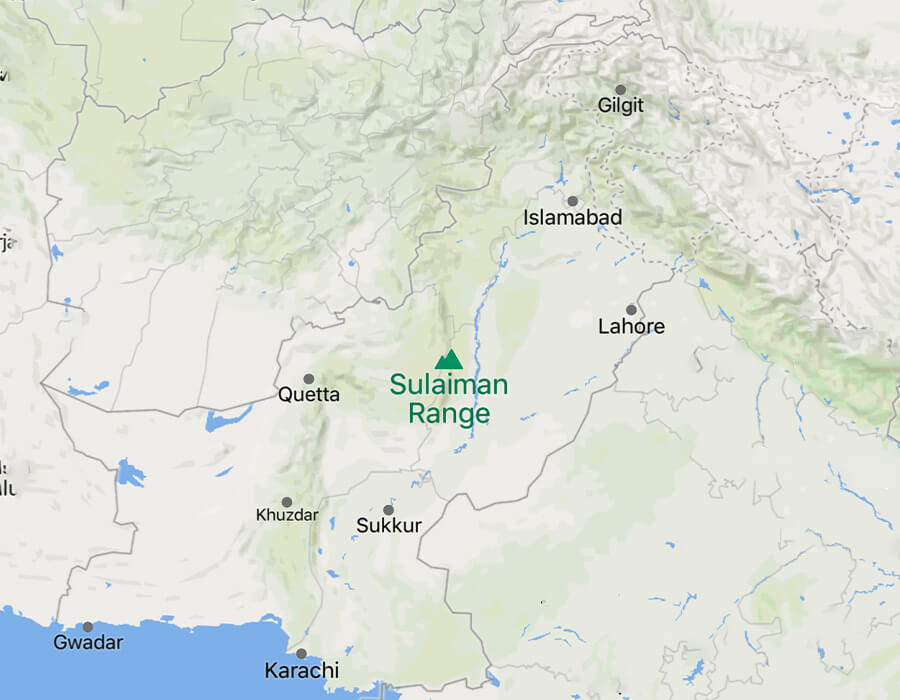
The Sulaiman Mountains, also known as Koh-e-Sulaiman, are a range of mountains located in Pakistan and Afghanistan. These mountains are an extension of the southern Hindu Kush mountain range. The range spans approximately 6,475 square kilometers and extends over Afghanistan’s Kandahar, Zabul, and Paktia provinces and parts of Balochistan, Waziristan, and Khyber Pakhtunkhwa in Pakistan.
The highest peak of the Sulaiman range is Zarghun Ghar at 3,578 meters. The most well-known peak is Takht-e-Sulaiman, also known as the “Throne of Prophet Solomon,” standing at 3,487 meters. The range creates a natural barrier against humid winds from the Indian Ocean, resulting in arid conditions in southern and central Afghanistan. The range influences the local geography, climate, and cultural narratives, making it an essential feature of the region.
The Sulaimans were formed due to the collision of the Indian Plate with the Eurasian Plate around 30 million years ago. This collision resulted in complex tectonic structures, including thrust faults. Notably, the range’s complex fault system can produce doublet earthquakes.
History
The mountains have many stories from a long time ago. In Pashtun tales, Takht-e-Sulaiman is linked to Prophet Solomon. It’s said that he went up the mountain to see the land of South Asia when it was very dark. Other legends connect the mountain to Noah’s Ark . It is said that after the big flood, Noah’s Ark landed on Takht-i Sulaiman.
Another story tells us that Qais Abdur Rashid, who is believed to be the important ancestor of the Pashtun people, is buried on top of Takht-e-Sulaiman. Because of this, the place is also called Da Kasi Ghar, which means “Mount of Qais” in the local language.
List of Mountains In Sulaiman Range
- Takht-e-Sulaiman
- Taunsa Sharif
- Khilafat Hills
- Kesai Ghar
- Zarghun Ghar
- Koh-i-Takatu
- Giandar
Toba Kakar Range
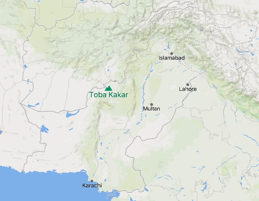
The Toba Kakar, or Toba Kakari, are a group of mountains in Pakistan and Afghanistan. They are part of the Sulaiman Mountains and are located in the Balochistan province of Pakistan, extending into the Kandahar and Zabul provinces of Afghanistan. The main path through these mountains is called the Bolan Pass.
In August 1979, there were suspicions that Pakistan might be using these mountains to develop nuclear weapons. The mountains were also used by the Taliban as a hiding place during the conflict in Afghanistan. Another area connected to these mountains, called Toba Achakzai, was where Ahmad Shah Durrani, who founded Afghanistan, spent some hot weeks during summers towards the end of his life.
Bolan Pass
The Bolan Pass is a natural pathway through a range of mountains in Pakistan. It’s like a narrow valley connecting one side of the country. This pass has been necessary for a long time because it allows people to travel between different areas. Traders, invaders, and tribes have all used this pass to move around. It’s also significant in history because it has been part of British campaigns and other important events.
On one side of the pass, there are mainly a group of people called Brahvi tribes; on the other, there are Pashtuns and Balochis. This pass is in a place where different geographic regions meet, and it’s valuable because it connects Pakistan, Afghanistan, Iran, and the Arabian Sea.
The pass has been used in history for invasions and travel. It’s similar to the well-known Khyber Pass. The British Army used it during wars, and there were challenges like rocky paths and robbers. In the late 1800s, the British took control of the pass from the local leaders.
There’s also a railway that goes through the pass but faces difficulties like floods and extreme temperatures. The pass has a mix of challenges and historical significance.
Central Brahui Range
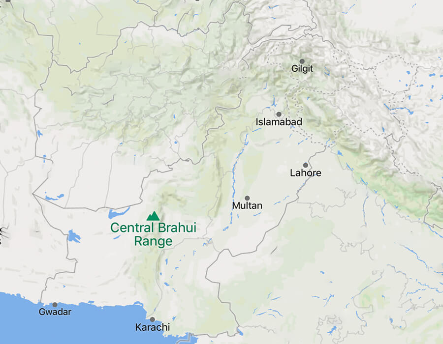
The Central Brahui Range is like a chain of hills in Pakistan, located in the middle of the Balochistan plateau. It stretches for about 225 miles from north to south and is covered with trees. There are valleys between the hills. It goes from the Pishin Lora and Zhob Rivers in the north to the Mula River in the south. The highest points are around 6,000 feet above sea level, and they get lower as you go south.
The range runs mostly from north to south, but it turns to the east-southeast near Quetta and connects with the Sulaiman Range. The main passes through these hills are the Bolan, Harnai, and Mula. In the southern part, the Brahui tribes are the main group of people, while in the north, there are mostly Pashtuns, with the Kakaṛs being the main group in the north.
Safed Koh Range
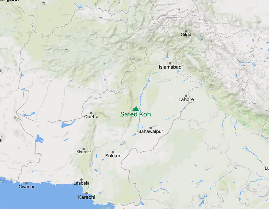
The Safed Koh range, also known as the White Mountains, is a range of tall hills and mountains in the southern part of Afghanistan and Pakistan. These mountains act like a natural border between the two countries. The highest peak is called Mount Sikaram, and it’s really tall, reaching about 15,600 feet. The Safed Koh or Spin Ghar mountains are important because they separate the Kabul and Kurram rivers.
They also have valleys where people grow things like wheat, vegetables, and cotton. The mountains have been used for a long time, even by groups like al-Qaeda, who crossed them to escape.
Conclusion
When we explore the mountains in western Pakistan, we find more than just a pretty view. These mountains show how nature, history, and people all interact. They hold stories from long ago, like myths about old prophets and stories from recent times. These mountains have many stories to tell, and they’re waiting for people to listen when they visit. People who like hiking, camping, and climbing will enjoy these mountains, and they’ll also get to experience the different cultures and types of life there. It’s like going on a special journey that you won’t forget.
Related Blogs
Top 15 Famous National Highways in Pakistan
A Comprehensive List of Motorways In Pakistan